
TOPOGRAPHICAL SURVEYS
BEFORE we get started on a Preliminary Floor Plan Design, we usually REQUIRE a Topographical Survey.
While getting a Topographical Survey may be an unexpected expense,it is invaluable for MANY reasons:
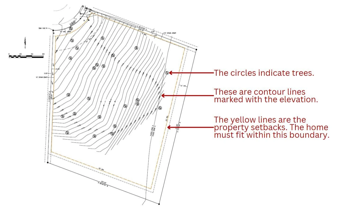
- The Survey has Property Lines, Lot Dimensions, and Setbacks.
- It shows Utilities, Trees, or Unique Features of the Property.
- Contour Lines show how the land lays. Is it level or does is rise / fall?
- An Electronic File is shared with us. We import this into our Design Software.
All of these things directly impact the home design, which is why it is required. See the brief explanation of the importance for each below.
PROPERTY LINES, LOT DIMENSIONS, & SETBACKS
We can design your dream home. However, if we complete the design without confirming it will fit on your property, it can lead to disappointment, frustration, and additional cost to change the design to make it fit. For this reason, it is extremely important for our team to know the parameters we are working in from the very beginning.
UTILITIES, TREES, AND UNIQUE FEATURES
Knowing where utilities, trees (that will be kept), and unique property features are allows us to design the home, out buildings, and driveway around them, avoiding unexpected changes later on.
CONTOUR LINES
Contour lines mark the elevation of the land every several feet, allowing our team to know how level the property is. When possible, it is very IMPORTANT for us to work “WITH” your land rather than “AGAINST” it.
In the steep terrain of the Ozark Hills, it’s not uncommon for challenging lots to ADD $ 50,000 – $ 150,000 to the cost of the foundation, driveway, retaining wall and infrastructure.
Contour lines allows our design team to make the best design decisions and is ESSENTIAL for the General Contractor to provide a more accurate estimate of the Total Cost to build your home.
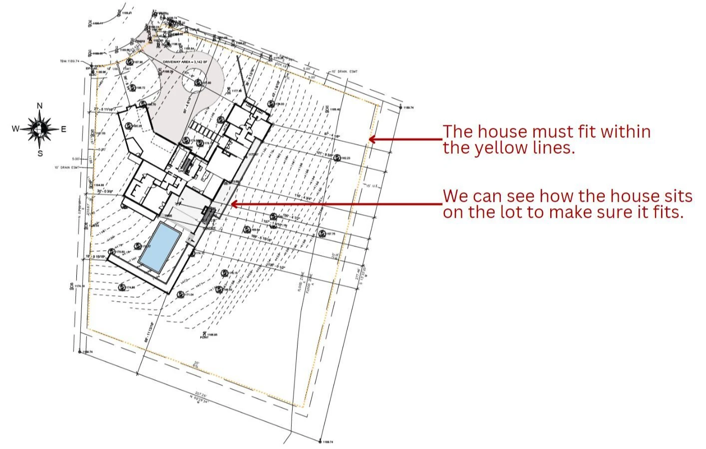
ELECTRONIC FILE
When the surveyor has completed the survey, they send us a file that we import directly into our design software. This allows us to design the home directly on the property so we know how the home will interact with the land, if the builder will need to dig out / fill in, as well as the need for retaining walls.
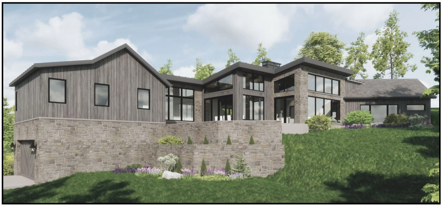
In this rendering, you can see how this house sits on the Client’s Property. Note how we have worked with the slope of the land. We have also planned for the necessary retaining walls.
IN CONCLUSION
We hope outlining these four things helps you better understand the importance of a Topographical Survey.
One last thing to keep in mind, is that most of the surveyors in our area often schedule 4-6 weeks out. It can then take an additional week or two for them to prepare our electronic file.
For this reason, we recommend getting the survey scheduled as soon as possible.
Having the survey file PRIOR to the Design Kick Off meeting, allows us to input it into our software and discuss exact location options during the initial meeting.
Then, we will be ready to start the Preliminary Floor Plan Design immediately after the Design Kick Off!